The recent tensions between India and China in Ladakh have thrown a spotlight on this often-forgotten disputed border. While much has been written and said about the Line of Control (LOC) and the conflict with Pakistan, India’s border dispute with China is far older, going back to the days of the Great Game of the 19th century, when the British and Russian empires vied for power in Central Asia, drawing borders on maps across unchartered terrain. It is impossible to understand the current conflict, without understanding this background.
The Galwan Valley face-off was most immediately triggered by India building a road that connects Leh, the capital of Ladakh, with the exotically named Daulat Beg Oldi, an Indian military base located on the northernmost tip of India, in the Karakoram mountains. Sitting 5,065 meters above sea level, Daulat Beg Oldi is also India’s highest military airstrip and flanks the Siachen glacier to the west and the Aksai Chin region to the east, while to it north-west lies the strategically important Shaksgam Valley, ceded by Pakistan to China in the 1960s.

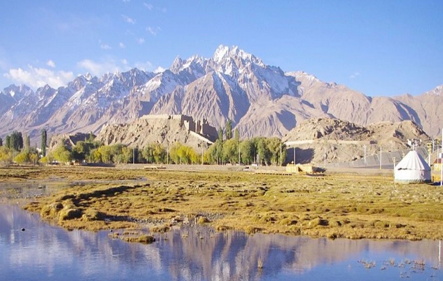
The Karakoram Pass
Daulat Beg Oldi has a fascinating history. The phrase, in a local Turkic dialect, literally means ‘a place where a rich and powerful man died’. This is where Sultan Said Khan of Yarkent Khanate (in Central Asia) died, of altitude sickness, in 1533 CE. Two years earlier, he had set forth with a large army and crossed the Karakoram Pass, aiming to enter the Indian subcontinent and ‘conquer Ladakh for Islam’. He didn’t make it very far.
The Karakoram Pass is just 12 km north of Daulat Beg Oldi, in the Karakoram Mountains, beyond which lie the great cities of the Tarim Basin (now in the Xinjiang province of China). While Indian history books are replete with references to the Khyber Pass and Bolan Pass, which historically connected the subcontinent with the rest of Asia, the Karakoram Pass was just as important.
To better understand the history of the region and what is happening there today, it is important to understand geography as well. Because of our Tibet-centric view vis-à-vis the Indo-China border, few in India realise how historically and culturally close we have been to the Tarim Basin all along. To put things in perspective, the city of Leh is about 400 km from Hotan and 600 km from Kashgar (the two great cities of the Tarim Basin), while it is located 1,003 km from New Delhi. Considering the geographical proximity, it is no surprise that the Basin and what is now our border had such close connections, referred to even in the Hindu epics.

The Tarim Basin & ‘Uttara Kuru’
In Hindu religious texts such as the Vedas and Puranas as well as the Mahabharata, there are references to a trans-Himalayan region known as ‘Uttara Kuru’ or ‘Northern Kuru’ believed to be the Tarim Basin. The earliest reference is found in the Rig Veda, which mentions Uttara Kuru as being a Janapada or a republic situated beyond the ‘parvatas’ (mountains).
In different Puranas, Uttara Kuru appears as a mythical land of spirits or land of enlightened sages. In the Mahabharata, the kings of Uttara Kuru were said to have been defeated by Arjuna. In the Ramayana, there is a reference to Uttara Kuru as ‘a land beyond the forests of Kichaka bamboo’. Historian Romila Thapar, in her book Early India: From the Origins to AD 1300 (2002), points out an interesting connection between ‘Kichaka bamboo’ and ‘Ki-Chok’, the ancient Chinese term for bamboo. Even the 2nd-century geographer Ptolemy, in his text Geographia, makes mention of ‘Ottorokorai’, which he places in Eastern China. All these points to the ancient connections between the Xinjiang region of China and India.

At the beginning of the 1st millennium CE, this was the route through the Karakoram Pass that the first Shakas or Indo-Scythians, Kushanas and later the Hunas used to enter India. This was the ‘Southern Flank’ of the Silk Road that connected China with the Roman Empire. From the town of Hotan, caravans carrying silk entered the subcontinent through the Karakoram Pass, after which the road bifurcated. One route went through Hunza (now in Pakistan-Occupied Kashmir) to Gandhara and Taxila via Manshera and Balakot. The other route followed the Daulat Beg Oldi-Shylok track (the same road that India is building now), down to Leh and beyond, to Himachal Pradesh and Tibet.
But this Tarim Basin-to-India route was an extremely treacherous path, due to the difficult topography, high altitudes and extreme climate. We get a sense of this from the words of the Chinese pilgrim Fa-Hien, who took this route in 400 CE. He writes, “The way is difficult and rugged, running along a bank exceedingly precipitous. When one approaches the edge of it, the eyes become unsteady, and if one wishes to go forward in the same direction, there is no place on which one can place a foot, and beneath are the waters of the river called the Indus.”
Interestingly, the powerful Emperor of Kashmir Lalitaditya Muktapida (724-761 CE) is known to have crossed the Karakoram Pass with his army, to establish control over the cities of Hotan and Yarkand in the Tarim Basin.

No Man’s Land Called ‘Aksai Chin’
In the medieval period, while land-based Central Asian trade lost importance, caravans continued to pass between Hotan and Leh. By 1000 CE, the Tarim Basin region had become ‘Turkified’ due to the migration of Muslim Turks from the Central Asian steppes, and was ruled by numerous Turkic ‘Khanates’. To the east of the Tarim Basin Khanates lay the great Tibetan Empire.
The only all-weather route that connected the cities of the Tarim Basin with Western Tibet passed through a barren, inhospitable and uninhabited area known as Aksai Chin, located east of Ladakh. Due to the remoteness of the region, it was only used by passing caravans and was a kind of no man’s land; neither Tibet nor Ladakh nor any Tarim Basin Khanates had any interest in controlling it. But this ancient caravan route between Xinjiang and Tibet would become critical in the border dispute between India and China in the 1950s and ’60s.
Ironically, the greatest threat that Ladakh and surrounding regions faced in the 1st millennium CE came from an aggressively expansionist Tibet. From the early 8th century onwards, Ladakh and other kingdoms in what is now Pakistan-Occupied Kashmir faced a series of Tibetan invasions, which made Ladakh a tributary of Tibet. This medieval connection would lead to claims by Communist China in the 1950s of Ladakh being ‘Chinese territory’.

The fact is that, during most of Ladakh’s history, China was nowhere in the picture, neither in Xinjiang nor in Tibet. It was only in the 1750s that the Qing Empire of China conquered the Tarim Basin, which it called Xinjiang, or Eastern Frontier in Madarin, and populated with Han Chinese and Uighur.
In the case of Tibet, the Mongol ruler Kublai Khan, grandson of Genghis Khan, conquered the kingdom in the 13th century and made it part of his empire. This formed the basis of Chinese claims to Tibet and its former dependencies like Ladakh.
But for most of history, going back millennia, the border regions between Ladakh, the Tarim Basin and Tibet remained uninhabited, uncharted and unclaimed. Until, that is, the Great Game of the 19th century.

The ‘Great Game’ of Central Asia
It is incredible that as late as the 1800s, when most of the world’s landmass had been explored and mapped, a vast swathe of Central Asia and Tibet was still a big blank on the world map. Then began a race among European explorers to chart these still-uncharted territories of Central Asia, fuelled by what was called The Great Game.
The Great Game was a political and diplomatic confrontation that existed for most of the 19th century between Great Britain and Russia, over Central Asia. Britain, which had established its empire in India, feared that the expansionist Russian Empire would invade India through Central Asia, and was determined to stop it at all costs.
In the 1830s, Ladakh, Baltistan, Hunza and numerous other kingdoms in the region became part of the Sikh Empire of Maharaja Ranjit Singh. Later, they would become part of the Dogra Kingdom of Maharaja Gulab Singh, thanks to the brilliant commander-in-chief General Zorawar Singh Kahluria. General Kahluria dreamt of conquering Tibet and was killed during a Tibet campaign in 1841, but the broad outlines of the land he united would remain the same until the year 2019, when the Indian Government bifurcated Jammu & Kashmir and Ladakh.

Interestingly, while the princely state of Jammu and Kashmir came into existence in 1846, there was no consensus on the eastern borders of the kingdom with Xinjiang and Tibet. As per the Treaty of Amritsar (1846) between Maharaja Gulab Singh of Kashmir and the British East India Company, the British considered the Karakoram Pass the northern frontier of the Dogra Kingdom, but the maharajas differed.
For example, Maharaja Gulab Singh’s successor, Maharaja Ranbir Singh of Kashmir, established a garrison and fort at Shahidullah (Xaidullah), which was 60 miles north of the Karakoram Pass, in Xinjiang. The British were disinclined to accept these claims, which they considered ‘too ambitious’. As a result, in 1867, Maharaja Ranbir Singh was forced to withdraw his troops from Shahidullah.

Making of the Ardagh-Johnson Line
The present-day Indian border with China, incorporating Aksai Chin, is formed on the basis of the Ardagh-Johnson Line of 1897. It was formally proposed to the British Indian government by Major General John Ardagh, chief of military intelligence in London, based on surveys of the Ladakh region conducted by noted British surveyor William Johnson in 1865.
To understand the context, most of the region around the Karakoram Pass and Aksai Chin was barren, arid, inhospitable and uninhabited. It was almost impossible in those pre-modern times to maintain military posts in these areas. So the rulers of Kashmir, Tibet and Xinjiang were happy to control important towns along the routes, while leaving mountains and valleys uncontrolled. While the broad outlines of the borders of the kingdom of Jammu and Kashmir were considered to be the Karakoram Pass in the north and the Pangong Lake in the east, there was no consensus on where the border lay in-between.
It was only with the advent of modern nation-states in the 20th century that the mapping of every square inch of international borders became imperative. During this time, British explorers, surveyors and cartographers explored every nook and corner of the region, to lay their ‘claim’ on these areas.

The town of Leh served as an important base for these British explorers. They were helped by local Ladakhis, who served as caravan guides. One such famous Ladakhi guide was Ghulam Rasool Galwan, who in 1899 helped a British expedition navigate a dangerous river valley in which they were lost. As a result, the grateful British named the river valley after him. It is this very Galwan Valley that is the bone of contention between India and China today.
Critically, the Ardagh-Johnson Line of 1897, which India considers its official border, was never presented to the Chinese Government by the British for approval. In 1899, The British Government created a new border line known as the Macartney–MacDonald Line, which left some areas of Aksai Chin to China. While this was presented to the Chinese Government in Beijing for approval by the British, the Chinese gave no official response to it. As a result, the Ardagh-Johnson Line continued to be used as the border in official British Indian maps.

Independence and the Border Dispute
With no official Chinese response to the British proposals, when India gained independence in 1947, the British just left behind the old border maps. But the political situation in China would soon change dramatically.
In 1949, the Communist Party of China conquered Xinjiang from local warlords, who had taken control from the Qing dynasty of China. This was followed by the Chinese conquest and annexation of Tibet, in 1950-51. Communist China rejected the old British border lines and laid claim to all of Aksai Chin. What had been a desolate no man’s land for a thousand years suddenly became a hotly disputed territory.
From 1947 to 1954, the Ladakh border between India and China had been officially marked as ‘undemarcated’ in Indian Government maps. On July 1, 1954, Indian Prime Minister Jawaharlal Nehru passed a memo stating that Aksai Chin was an integral part of India and all official maps should reflect this. While the Indian government claimed Aksai Chin, it made no attempt to take possession of it. Till 1958, there was not a single Indian soldier or military outpost in the desolate Aksai Chin region and this gave the Chinese an opportunity to simply walk over and take control.
In 1956, the Chinese converted the ancient all-weather caravan route between Xinjiang and Tibet, passing through Aksai Chin, into a modern motorable road. All the time that that road was being built, the Indian Government had no idea this was happening. The road then appeared on Chinese maps, in 1958, and there was an uproar in India. The India Government then decided to build border posts in Aksai Chin to claim its territory, but it was too late.

Galwan Valley in 1962
A few years later, in 1962, the Galwan Valley in Ladakh became a flashpoint between India and China. This valley is strategically important to India because of its proximity to the road to Daulat Beg Oldi; for China, it provides easy access to the Aksai Chin plateau.
On July 4, 1962, a platoon of Indian troops built a military post in the Galwan Valley to counter aggressive Chinese moves. This evoked huge protests from the Chinese Government. Chinese troops surrounded the Galwan post and laid siege to it. The Indian Government was determined to hold on, and the post received supplies via helicopter for months.
All these efforts were in vain. When the India-China war broke out in October 1962, the Galwan post was overwhelmed and destroyed by Chinese troops; 33 Indian soldiers were martyred and their commanding officer and many other soldiers taken prisoner.
The recent conflict in the Galwan Valley and Pangong Lake area is a continuation of this dispute. Sadly, we have already lost our ancient connection with the Tarim Basin and Tibet. How this current face-off will pan out, even history can’t provide hints to, as two giants battle over a strip of land that went unnoticed for so long.
Ref URL – https://bit.ly/2Vde78C
